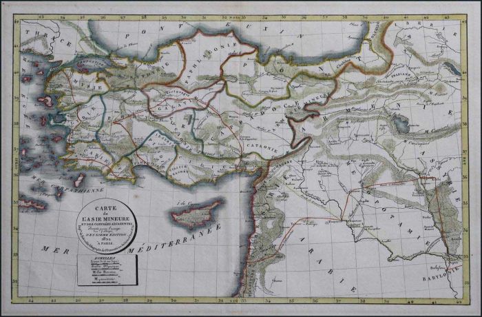
"Carte de L'Asie Mineure et des Contrees Adjacentes... 1822 a Paris" beautifully hand coloured map centered on Turkey, extending from east Aegean to Iraq, including Cyprus & Syria. Map dim. 44x30cm. Very Fine condition.
Auction #470 - Maps & Engravings, Books, Photographs, Bonds
By: A. Karamitsos
A. Karamitsos Auction #470 - Maps & Engravings, Books, Photographs, Bonds
A. KARAMITSOS is holding an auction of Maps & Engravings, Books, Photographs and Bonds with 690 spectacular items, including:
Maps & Engravings
PAPER MONEY - BANKNOTES
Photograpgs
Bonds & Certificates
Books
Newspaperts & Magazines
Engravings
Ephemera
Documents
Refine Your Search
filtern nach
Category
- various countries - archive photographs (171) Apply various countries - archive photographs filter
- various countries - bonds and certificates (43) Apply various countries - bonds and certificates filter
- various countries - books (16) Apply various countries - books filter
- various countries - documents (4) Apply various countries - documents filter
- various countries - engravings (199) Apply various countries - engravings filter
- various countries - ephemera (6) Apply various countries - ephemera filter
- various countries - maps (221) Apply various countries - maps filter
- various countries - newspapers - magazines (30) Apply various countries - newspapers - magazines filter
- Various countries - paper money - banknotes (1) Apply Various countries - paper money - banknotes filter
Lot #8202 - various countries - maps
"Essai sur la Topographie de SPARTE et de ses Environs" engraved by A.Tardieu and published in "Voyage du Jeune Anacharsis en Grece", 1825. Copper engraved antique map in very good condition. Size: ca. 21 x 14 cm. plus margins, in frame.
Lot #8203 - various countries - maps
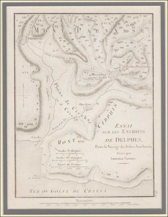
"Essai sur les Environs de DELPHES" engraved by A.Tardieu and published in "Voyage du Jeune Anacharsis en Grece", 1825. Copper engraved antique map in very good condition. Size: ca. 20 x 14 cm. plus margins, in frame.
Lot #8204 - various countries - maps
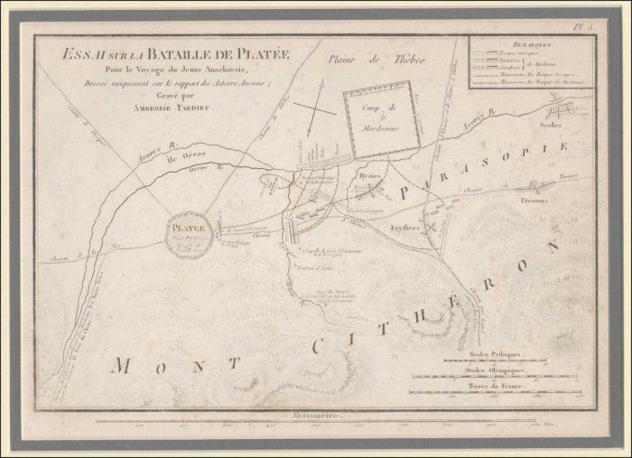
"Essai sur la Bataille de Platee" engraved by A.Tardieu and published in "Voyage du Jeune Anacharsis en Grece", 1825. Copper engraved antique map in very good condition. Size: ca. 22 x 15 cm. plus margins, in frame.
Lot #8205 - various countries - maps
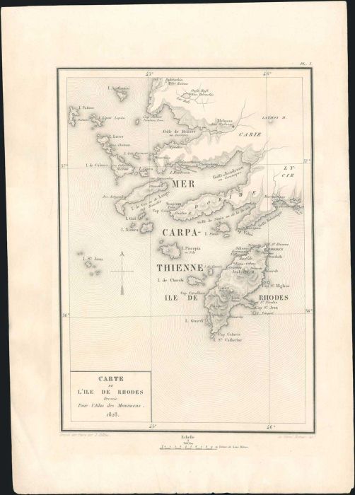
Three pages from "Bernard Eugene Antoine ROTTIERS: Description des monumens de Rhodes" published in 2 volumes in Brussels, these being from the volume with the plates (1828) (the volume with the text was published in 1830): 1) Title page "Monumens de RHOD
Lot #8206 - various countries - maps
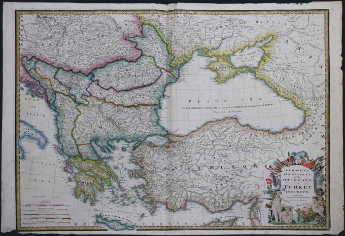
WYLD J. "European Dominions of the Ottomans, or Turkey in Europe" c.1830, large 73x55cm, coloured copper plate map. Very detailed map of Greece, Turkey, Black Sea, part of Cyprus. Railways indicated. Few tears along margins, crease along upper part of cen
Lot #8207 - various countries - maps
"CHART of the Communication between the ARCHIPELAGO and BLACK SEA" Lizard D. 1831. Large 84x17cm colour engr. map of Dardanelles, Sea of Marmora & Bosporus-Constantinople. Slight foxing.
Lot #8208 - various countries - maps
"Expedition du Jeune CYRUS et retraite des Dix Mille" DELAMARCHE 1836, outline coloured copper plate map, presenting the route of Cyrus the Younger and the Ten Thousand Greek mercenaries through Persia. Map dim.41x28cm. Very Fine condition.
Lot #8209 - various countries - maps
"Petit Bocas de SAMOS" copper engraved map, complete page No. 48, probably from the book "Recueil des Principaux Plans des Ports et Rades de la Mer Mediterranee nouvellement publies par les meilleur Auteurs, Genes 1848, Chez Yves Gravier, Libraire derrier
Lot #8210 - various countries - maps
TARDIEU A. "TURQUIE D'EUROPE & GRECE" mid. 19th cent. steel engr. map of Balkans, Greece & Asia Minor. Detailed & accurate topography & hydrography. Outline hand coloured. Map dim.34x43cm. Very Fine condition.
Lot #8211 - various countries - maps
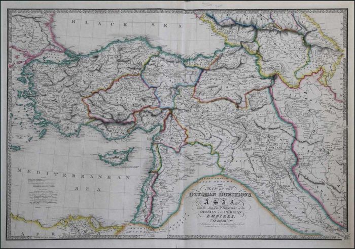
"Map of the OTTOMAN DOMINIONS in ASIA with the adjacent frontiers of the Russian and Persian Empires..." WYLD J. 1855/1864 large 50x70cm hand coloured, high detailed map. Presenting the extent of Ottoman Empire, including Turkey, Cyprus, Anatolia, Middle
Lot #8212 - various countries - maps
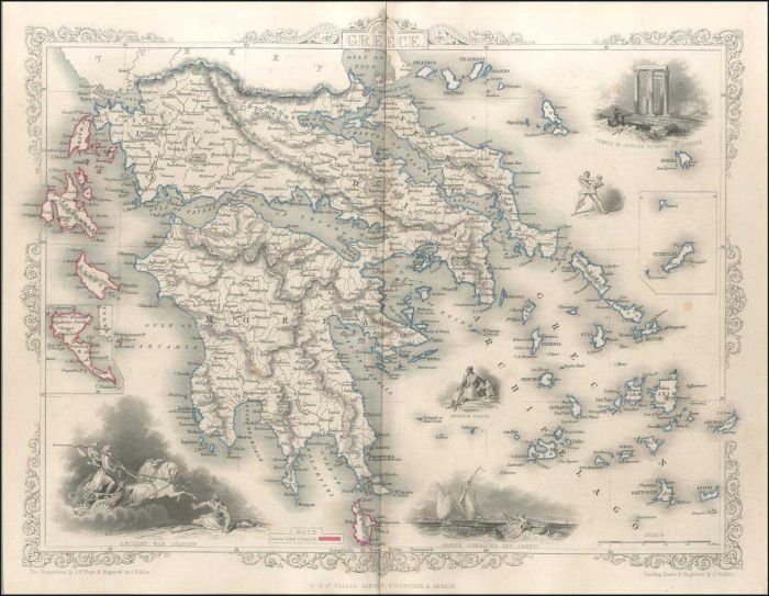
RAPKIN J. "Ionian Isles and Greece" c.1856 (Tallis J. London) Original outline colour. Double page steel engraved map of Greece with vignette illustrations of the Temple of Jupiter Olympus, Corfu, ships and an ancient chariot. Decorative scrolling and tit
Lot #8213 - various countries - maps
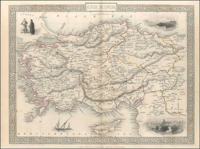
RAPKIN J. "ASIA MINOR" c.1856 (Tallis J. London) Original outline colour. Double page steel engraved map concentrating on what is now modern Turkey. Three vignette illustrations including one of Rhodes. Decorative scrolling and title cartouche around the
Lot #8214 - various countries - maps
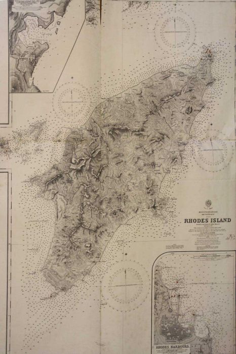
BRITISH ADMIRALTY "Mediterranean Grecian Archipelago. RHODES ISLAND. By Commander Thomas Graves in H.M.S. Beacon. 1841. London 1862 (Updated to 1961.) B/W. 84 x 102 cm. Intensely detailed chart of the island in the Dodecanese Group between Greece and Turk
Lot #8215 - various countries - maps
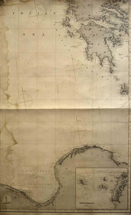
"(The Hydrographic Office of the Admiralty) Eastern Portion of the Mediterranean Sea / compiled from the most recent surveys / London, published by James Imray & son, 1879" three large size naval charts with maps of Northern Africa, Ionian islands & Pelop
Lot #8216 - various countries - maps
ATHENS. Two maps depicting the topography of the ancient times & early 20th century. Map dim.: 25.5x19cm & 23.5x18.5cm. Both in Fine condition.
Lot #8217 - various countries - maps
"Samos, Icaria, Fournoi, Patmos, Lipsoi, Arkoi, Agathonissi, Farmakonissi" Turkish map (only Ottoman names), scale 1:200.000, litho. printing (ca. 1920), folded in 8 parts & mounted/enforced on cloth. Size: 60 x 50 cm.
Lot #8218 - various countries - maps
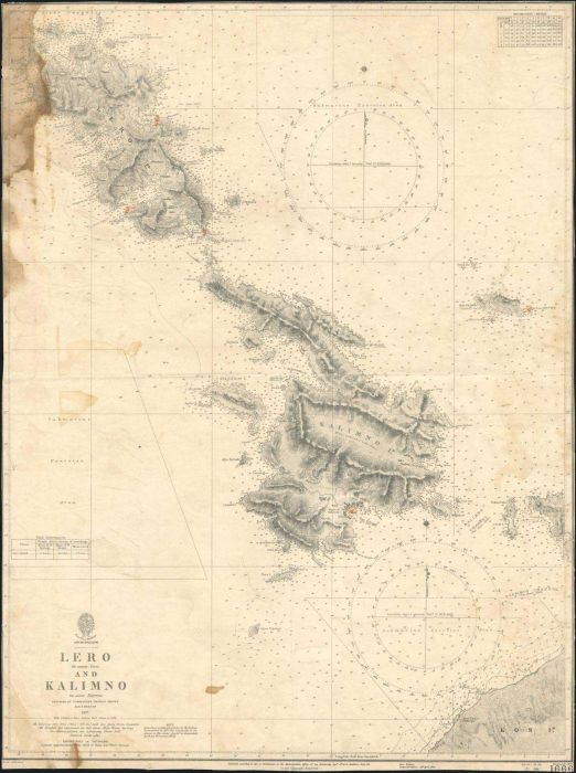
BRITISH ADMIRALTY "Archipelago. LERO AND KALIMNO. By Commander Thomas Graves in H.M.S. Beacon. 1837. London 1844 (Updated to 1939.) B/W. 48 x 64 cm. Intensely detailed chart of the 2 islands in the Dodecanese Group between Greece and Turkey in the Aegean
Lot #8219 - various countries - maps
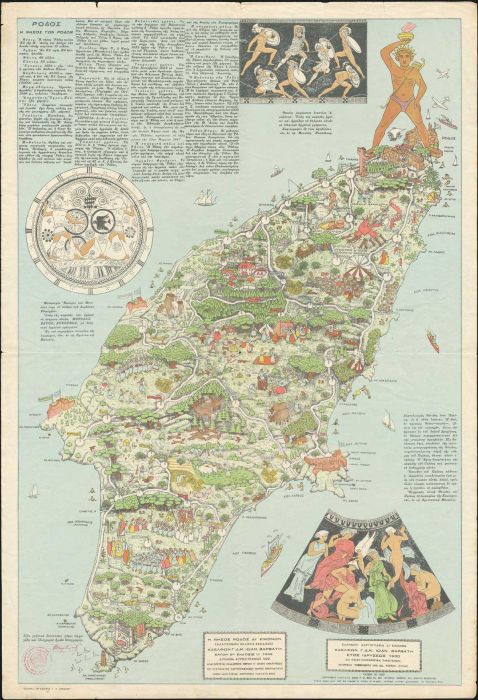
"Η νήσος Ρόδος δι' εικόνων / Καλλιτεχνική έκδοσις - σχεδίασις Αδελφών Γ.Δ.-Κ.Ιωάν. Βαρβάτη / Έργον 5ον Έκδοσις 1η 1946": Large lithographed colour map, printed by the Army Geographical Service. Size: 43 x 63 cm. Very beautiful & impressive in VG condition
Lot #8220 - various countries - maps
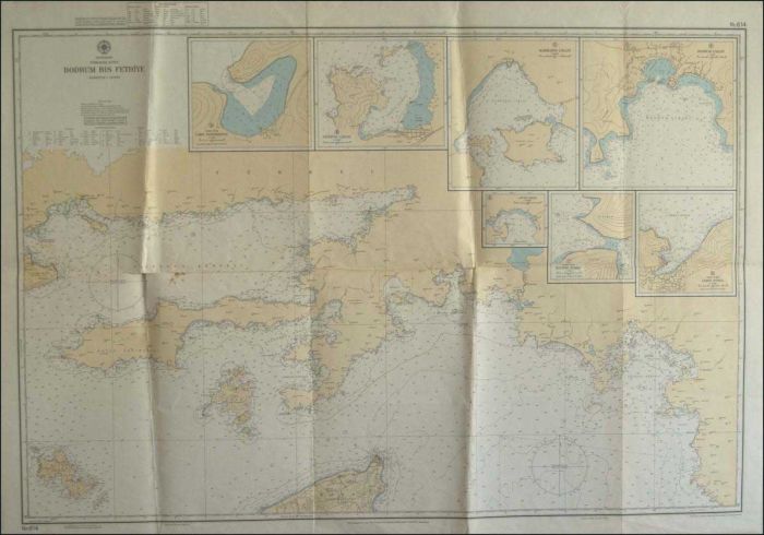
"Mittelmeer / Turkische Kuste / Bodrum bis Fethiye" large hydrographic map Nr.614 of the German Hydrographic Institute of Hamburg, edition of October, 1976 (with 8 detailed maps incl. some of the Dodecanese islands). Size: 115 x 90 cm.
Lot #8221 - various countries - maps
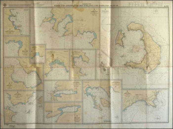
"Agaisches Meer / Haffen und Ankerplatze der Kykladen und Dodekanes, Blatt III" large hydrographic map Nr.1091 of the German Hydrographic Institute of Hamburg, edition of March, 1978 (14 detailed maps of islands). Size: 115 x 85 cm.
Lot #8222 - various countries - engravings
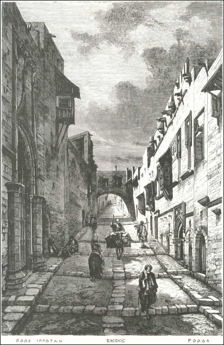
4 modern b/w prints: 1. Rhodos (Οδός Ιπποτών), 2. Rhodes / Medieval town, 3. Old town - Rhodos, 4. Rhodes: General view of the old City (from an old picture).
Lot #8223 - various countries - engravings
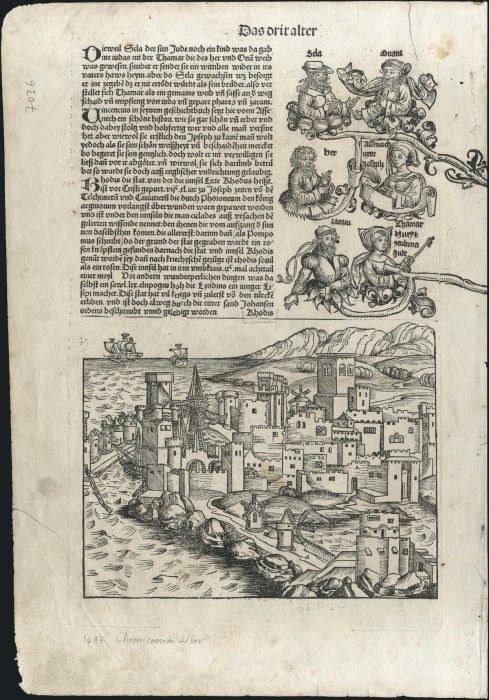
"RHODIS" complete page with a woodcut engraving of the town of Rhodes (17,5 x 22,5 cm) from the book "Liber chronicarum Secunda etas Mundi" by Hartmann Schedel, popularly known as "The Nuremberg Chronicle". German edition, published in Nuremberg 1493 by A
Lot #8224 - various countries - engravings
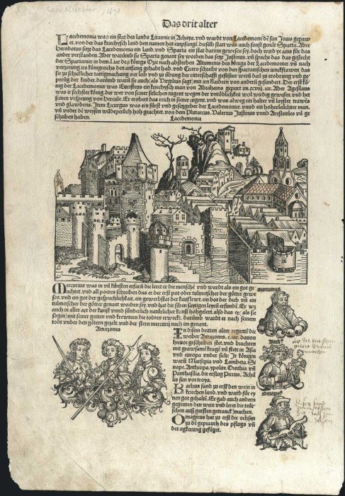
"Lacedemonia" complete page with a woodcut engraving of the town of Sparta (14,5 x 22,5 cm) from the book "Liber chronicarum Secunda..." by Hartmann Schedel, popularly known as "The Nuremberg Chronicle". German edition, publ. in Nuremberg 1493 by Anton Ko
Lot #8225 - various countries - engravings
NUREMBERG CHRONICLE, SCHEDEL H. "Athene vel Minerva", Nuremberg 1493. Original incunable leaf from the Nuremberg Chronicle featuring a woodcut view of Athens. Latin text above image and on verso. Numerous portraits set within text on recto and verso, with
A. Karamitsos
A. Karamitsos are experienced auctioneers of Philatelic, Numismatic and Post Card. We are specialists in the stamps and postal history of Greece, Greek Errors, New Greek Territories, Levant,... Read More
Send Email to A. Karamitsos Or Visit WebSite


