Archivieren
By: A. Karamitsos
lot # 8189 - various countries - maps
Saturday Dec 07, 2013 11:45 Europe/Athens
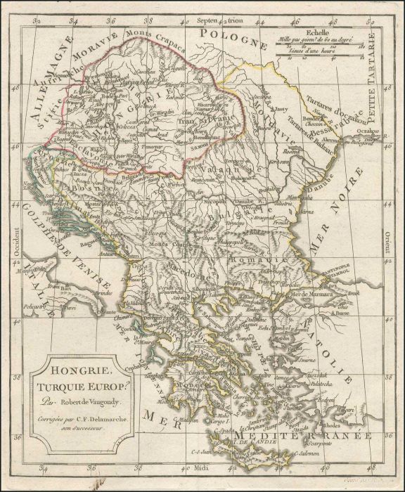
"Hongrie, Turquie Europ" c.1800 copper engr. map by Robert de Vaugondy, revised & publ. by Delamarche, presenting the extent of Hungary, Balkans & Greece. Outline hand colour. Map dim. 21x25cm. Very Fine. Not in Zacharakis.
M
Category:
About The Seller
A. Karamitsos
A. Karamitsos are experienced auctioneers of Philatelic, Numismatic and Post Card. We are specialists in the stamps and postal history of Greece, Greek Errors, New Greek Territories, Levant,... Read More
Send Email to A. Karamitsos Or Visit WebSite
more from this sale


more from other sales


