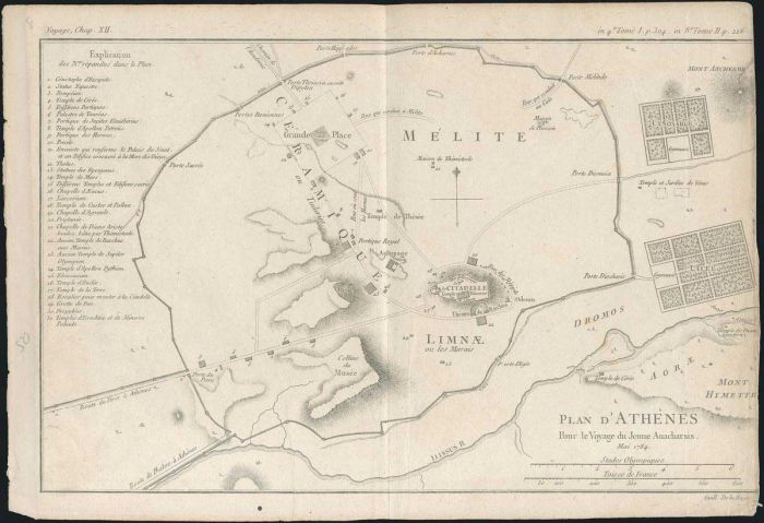
"PLAN D'ATHENES Pour le Voyage du Jeune Anacharsis Mai 1784 / Guill. De La Haye" copper plate topographical map by Barbie Du Bocage from J.J.Barthelemy's "Receuil de cartes et plans pour le voyage..." 1788-1791, 1795. Plan of ancient Athens with extensive
Auction #470 - Maps & Engravings, Books, Photographs, Bonds
By: A. Karamitsos
A. Karamitsos Auction #470 - Maps & Engravings, Books, Photographs, Bonds
A. KARAMITSOS is holding an auction of Maps & Engravings, Books, Photographs and Bonds with 690 spectacular items, including:
Maps & Engravings
PAPER MONEY - BANKNOTES
Photograpgs
Bonds & Certificates
Books
Newspaperts & Magazines
Engravings
Ephemera
Documents
Refine Your Search
Filtrer par
Category
- various countries - archive photographs (171) Apply various countries - archive photographs filter
- various countries - bonds and certificates (43) Apply various countries - bonds and certificates filter
- various countries - books (16) Apply various countries - books filter
- various countries - documents (4) Apply various countries - documents filter
- various countries - engravings (199) Apply various countries - engravings filter
- various countries - ephemera (6) Apply various countries - ephemera filter
- various countries - maps (221) Apply various countries - maps filter
- various countries - newspapers - magazines (30) Apply various countries - newspapers - magazines filter
- Various countries - paper money - banknotes (1) Apply Various countries - paper money - banknotes filter
Lot #8177 - various countries - maps
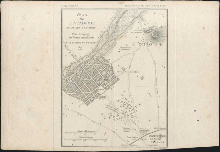
"PLAN DE L'ACADEMIE ET DES SES ENVIRONS Pour le voyage du Jeune Anacharsis Par M.BARBIE DU BOCAGE. Mai 1784/Guill De La Haye" copper plate map by Barbie du Bocage from Barthelemy's "Recuil de cartes et plans..." 1788-1791,1795. Map dim.: 16.5x21.5cm. Stai
Lot #8178 - various countries - maps
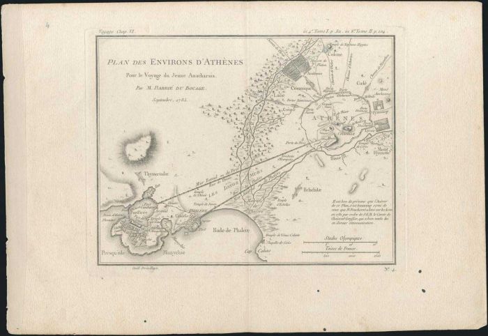
"PLAN DES ENVIRONS D'ATHENES Pour le Voyage du Jeune Anacharsis. Par M.BARBIE DU BOCAGE. Septembre 1785" coper plate map by Barbie du Bocage from J.J.Barthelemy's "Receuil de cartes et plans pour le voyage..." 1788-1791, 1795. Topographical plan of ancien
Lot #8179 - various countries - maps
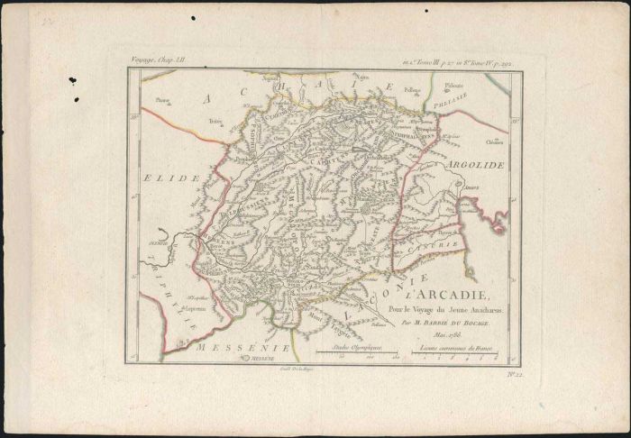
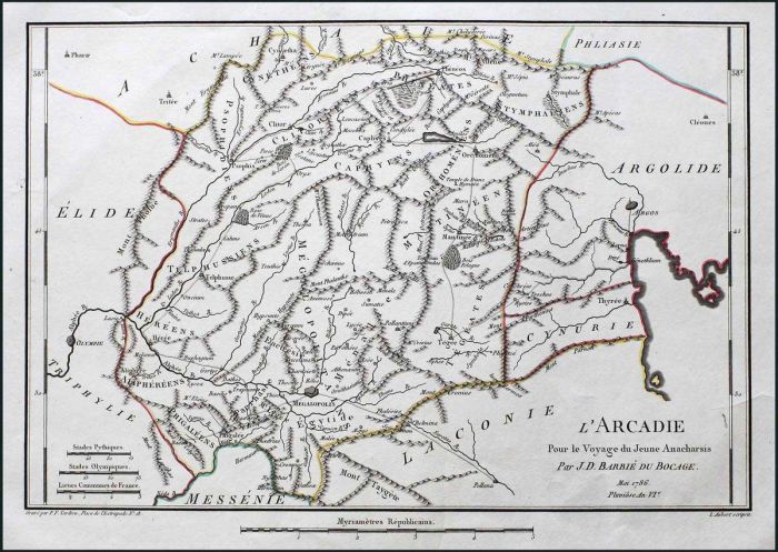
"L'ARCADIE, pour le Voyage du Jeune Anacharsis. Par M.BARBIE DU BOCAGE. Mai 1786/Guill De La Haye" coper plate map by Barbie du Bocage from J.J.Barthelemy's "Receuil de cartes et plans..." 1788-1791,1795. Map Dim.: 21.5x16cm. Few worm holes on upper and l
Lot #8180 - various countries - maps
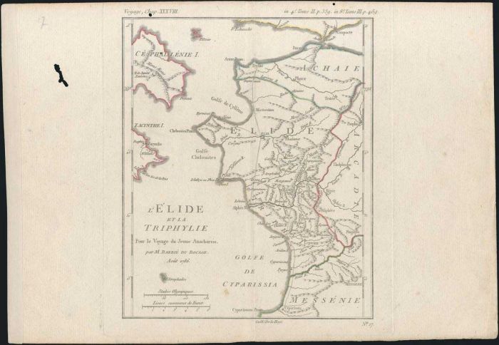
"L'ELIDE ET LA TRIPHYLIE Pour le Voyage du Jeune Anacharsis. Par M.BARBIE DU BOCAGE. Aout 1786/Guill De La Haye" coper plate map by Barbie du Bocage from J.J.Barthelemy's "Receuil de cartes et plans..." 1788-1791,1795. Map Dim.: 17x21cm. Few worm holes on
Lot #8181 - various countries - maps
"ATTICA from an Actual Survey by Mr. Stuart/Drawn by A.Arrowsmith/J.Walker sculpt." J. Stuart 1794 from "Antiquities of Athens". Large detailed topographical map of Attica from Oropos to the north to Sunion to the south and Salamina, Egina and Makronisos
Lot #8182 - various countries - maps
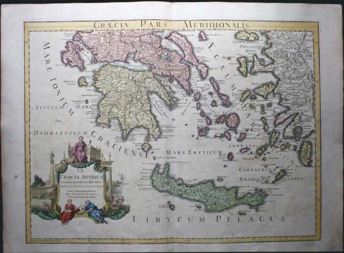
Two maps "GRAECIAE PARS MERIDIONALIS/I.II. GRAECIA ANTIQUA ad accuratas Recentiorum..." and "GRAECIAE PARS SEPTENTRIONALIS Autore Guillemo Delisle." copper engraved maps by G.Delisle c. 1795. Greece is presented in high detail in these two large maps, Dim
Lot #8183 - various countries - maps
"ESSAI SUR LA TOPOGRAPHIE DE SPARTE Pour le Voyage du Jeune Anacharsis. Juillet 1783/P. De La Haye fils" coper plate map by Barbie du Bocage from J.J.Barthelemy's "Receuil de cartes et plans..." 1788-1791,1795. Depicting the environs of ancient Sparta, wi
Lot #8184 - various countries - maps
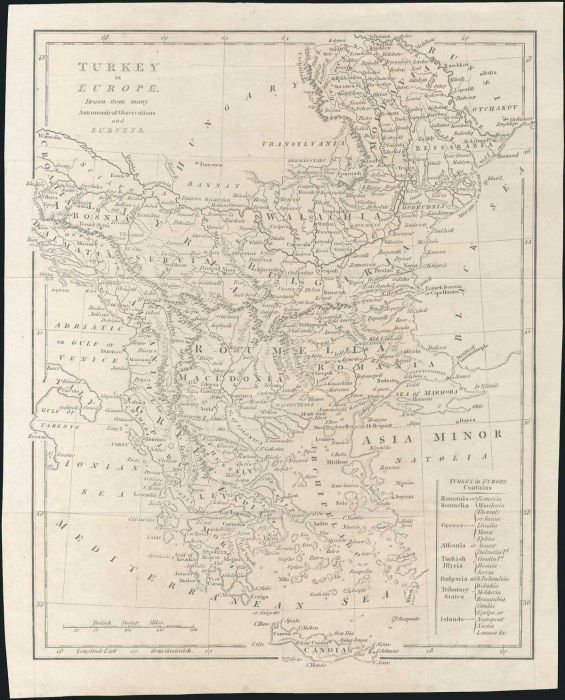
"TURKEY in EUROPE Drawn from many Astronomical Observations and SURVEYS/TURKEY in EUROPE Contains Romania, Roumelia, Greece, Albania, Turkish Illyria, Bulgaria, Tributary States, Islands" Unidentified copper engraved map c. 1795, depicting Greece and the
Lot #8185 - various countries - maps
"L'ARCADIE Pour le Voyage du Jeune Anacharsis Par J.D.BARBIE DU BOCAGE. Mai 1786 Pluviose An VIe/P.F.Tardieu Place de l'Estrapade No 18/L.Aubert sculpist" copper plate map by Barbie Du Bocage from Barthelemy's "Receuil de cartes et plans..." edition "An V
Lot #8186 - various countries - maps
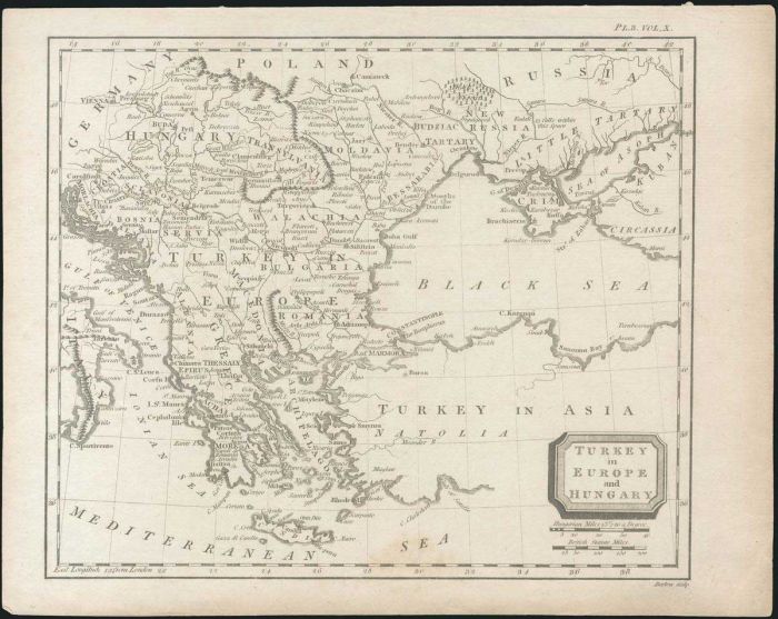
"TURKEY in EUROPE and HUNGARY/Barlow sculp." P. Barlow c. 1800 from "Complete & Universal Dictionary". Copper engraved map, dim.:22x18.5cm depicting the extent of Turkish domination in Europe. Some foxing on lower part, otherwise Very Fine condition.
Lot #8187 - various countries - maps
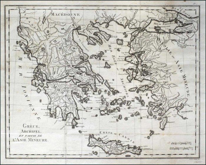
"GRECE, ARCHIPEL, ET PARTIE DE L'ASIE MINEURE." G.A. Olivier 1801 in "Atlas pour servir au voyage dans l'Empire Othoman, L'Egypte" ed. Paris. Rare copper engraved map, uncoloured presenting Greece, Aegean and Asia Minor. Map Dim.: 43.5x34cm. Cut on left l
Lot #8188 - various countries - maps
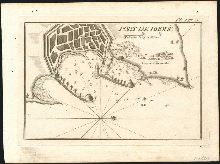
"Port de Rhode". Two copper engraved maps by Joseph Roux, from "Recueil des principaux plans des Ports et Rades de la Mer Mediterranee escraits de ma carte en 12 feuilles", Marseilles, ed. by J.J. Allezard. Pl. 127 is from the edition of 1800. In the 1801
Lot #8189 - various countries - maps
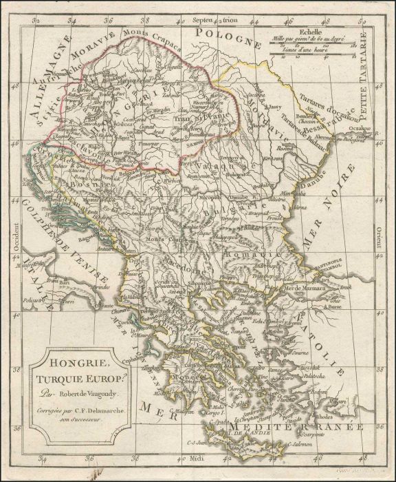
"Hongrie, Turquie Europ" c.1800 copper engr. map by Robert de Vaugondy, revised & publ. by Delamarche, presenting the extent of Hungary, Balkans & Greece. Outline hand colour. Map dim. 21x25cm. Very Fine. Not in Zacharakis.
Lot #8190 - various countries - maps
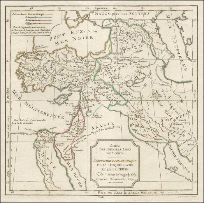
VAUGONDY R. "Carte des Premiers Ages du Monde. GEOGRAPHIE ECCLESIASTIQUE de la Turquie d'Asie et de la Perse...", Paris, late 18th century map of Turkey, Anatolia & Arabic peninsula, showing the geographical division of Patriarchs. Map dim.25x24cm. Map ar
Lot #8191 - various countries - maps
"Chart of the BAY of MARMORICE on the Coast of ANATOLIA...from an Actual Survey taken in 1801" Neele S. J. Copper engr. sea chart of MARMARIS bay in TURKEY, publ. by Cadell & Davies in 1803. Map dim. 25x20cm. Few light brown spots.
Lot #8192 - various countries - maps
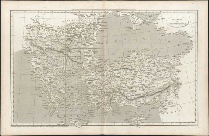
"ENVIRONS OF CONSTANTINOPLE." M.Arrowsmith 1806, publ. by Longman Hurst Rees& Orme Paternoster Row. Interesting uncoloured copper engraved map, presenting Greece, Southern Balkans, Black Sea and Asia Minor as the environs of Constantinople. Map Dim:40x25.
Lot #8193 - various countries - maps
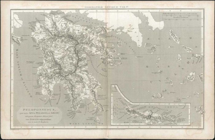
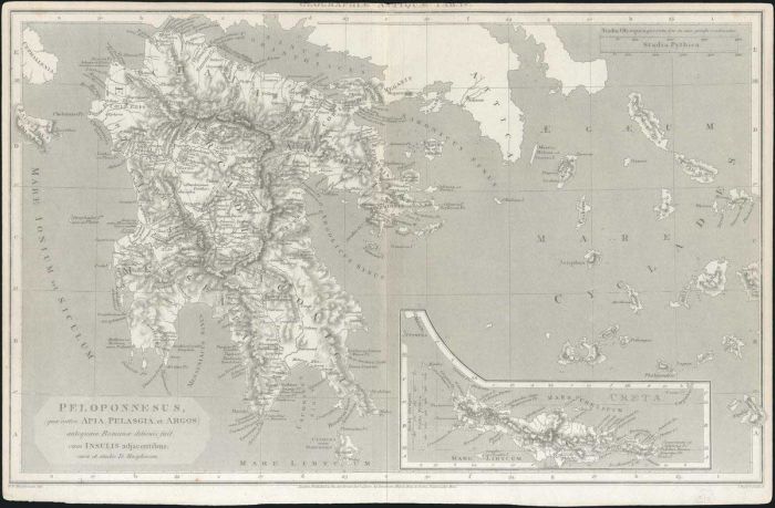
Two maps "HELLAS sive GRAECI PROPRIA,THESSALIA, et EPIRUS antequam Romanae ditionis fuerunt cura et studio D.Macpherson" and "PELOPONNESUS, (quae antea APIA,PELASGIA et ARGOS) antequam Romanae ditionis fuit, cum INSULIS adjacentibus cura et studio D. Macp
Lot #8194 - various countries - maps
"PELOPONNESUS, (quae antea APIA,PELASGIA et ARGOS) antequam Romanae ditionis fuit, cum INSULIS adjacentibus; cura et studio D.Macpherson" copper plate map by W.W. Macpherson, engraved by J.Russell, publ. Longman,Hurst,Rees & Orme, 1807, London. Depicting
Lot #8195 - various countries - maps
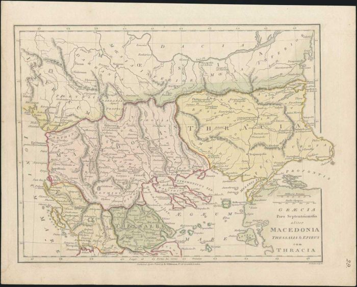
"GRAECIA Pars Septentrionalis aliter MACEDONIA THESSALIA & EPIRUS cum THRACIA", copper engraved map "Published April 1st.1808, by R.Wilkinson" in London, engraved by B.Smith with detailed topography and place names. Size: 22x28cm, condition: VF, with minn
Lot #8196 - various countries - maps
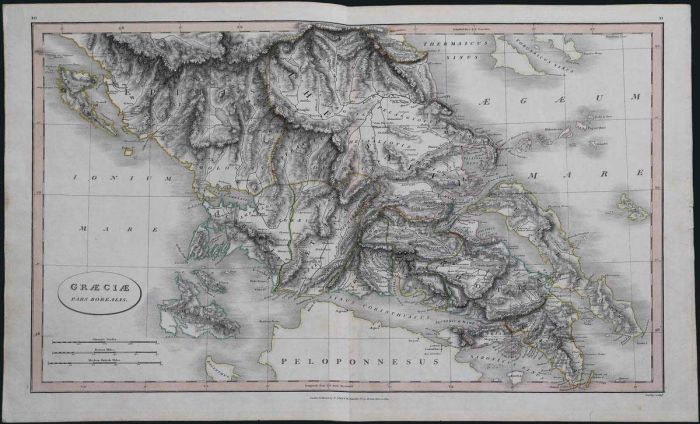
"GRAECIAE Pars Borealis" publ. by C. Smith, 1809, Jos. Bye sculp. Copper plate map of ancient Central Greece. Outline handcoloured. Map dim. 56x35cm. Very Fine.
Lot #8197 - various countries - maps
Copper engraved map of Greece, Asia minor, southern Balkans and Crete in lower left inset, "Published Nov.1st.1814 by S & G.Neele 352 Strand", with "J WHATMAN/1813" paper watermark, size: 28x43cm in excellent condition.
Lot #8198 - various countries - maps
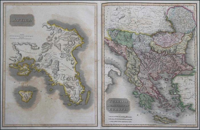
"ATTICA / Turkish Dominions in Europe" Thomson J. c.1815, Engr.: Mitchel E. Two highly detailed maps on single sheet. Attica on left & Greece and the Balkans (Rumelia, Serbia, Bulgaria, Bosnia, Croatia, Dalmatia etc). Each map dim.33x46cm, sheet dim. 75x5
Lot #8199 - various countries - maps
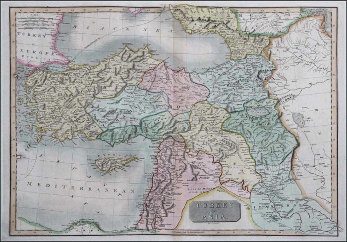
THOMSON J. "TURKEY in ASIA" 1817, engr. by Dessauville W. Hand coloured copper engr. map of the Ottoman Empire in Asia, the map frame extending from Asia Minor to Iran & from Black Sea to Egypt. Including Cyprus & Middle East. Map dim.51x39cm. In Excellen
Lot #8200 - various countries - maps
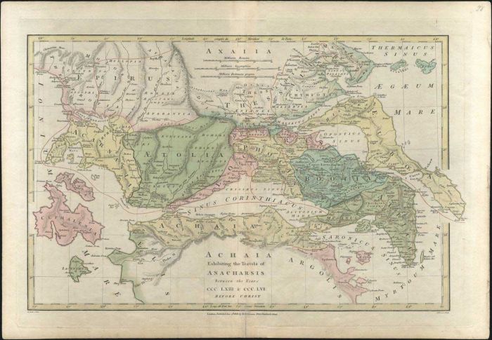
"ACHAIA Exhibiting the Travels of ANACHARSIS between the years CCC.LXIII & CCC.LVI Before Christ / E. Baker E. Bourne", pub. Wilkinson 1818. Map depicting the travels of Anacharsis in Greece. Map dim. 27x43cm. Small tear on bottom margin.
A. Karamitsos
A. Karamitsos are experienced auctioneers of Philatelic, Numismatic and Post Card. We are specialists in the stamps and postal history of Greece, Greek Errors, New Greek Territories, Levant,... Read More
Send Email to A. Karamitsos Or Visit WebSite


